Archer Heritage
  • Home
  • Featured Work
  • Services
  • About Us
  • Contact
  • info@archerheritage.ie

Collon, Co. Louth

<< Go back

Collon, Co. Louth

A proposed sporting facility development at Collon, Co. Louth was revealed to be an early Bronze Age cremation cemetery.Similar burials were found ~300 m to the SW in the 1950’s. Six cremation burials were recorded. At least two adults and one juvenile were included in the bone assemblage from the site. The human remains did not represent full individuals, but were rather partial or token deposits. Three were accompanied by funerary vessels inverted over cremated bone.A fourth had only the base of an upright cinerary urn remaining. All vessels had sustained substantial post-depositional damage from later ploughing.

Two vessels survived relatively intact, a bipartite vaseand a cordoned urn. Alder charcoal retrieved from beneath the bipartite inverted vase was radiocarbon dated to 1900–1730 BC. Considering the typology of the accompanying pottery vessels, a short period of burial activity around 1750 BC was most likely.

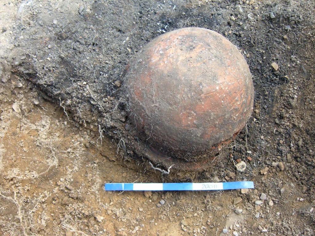
Mid-excavation view of bipartite vessel.

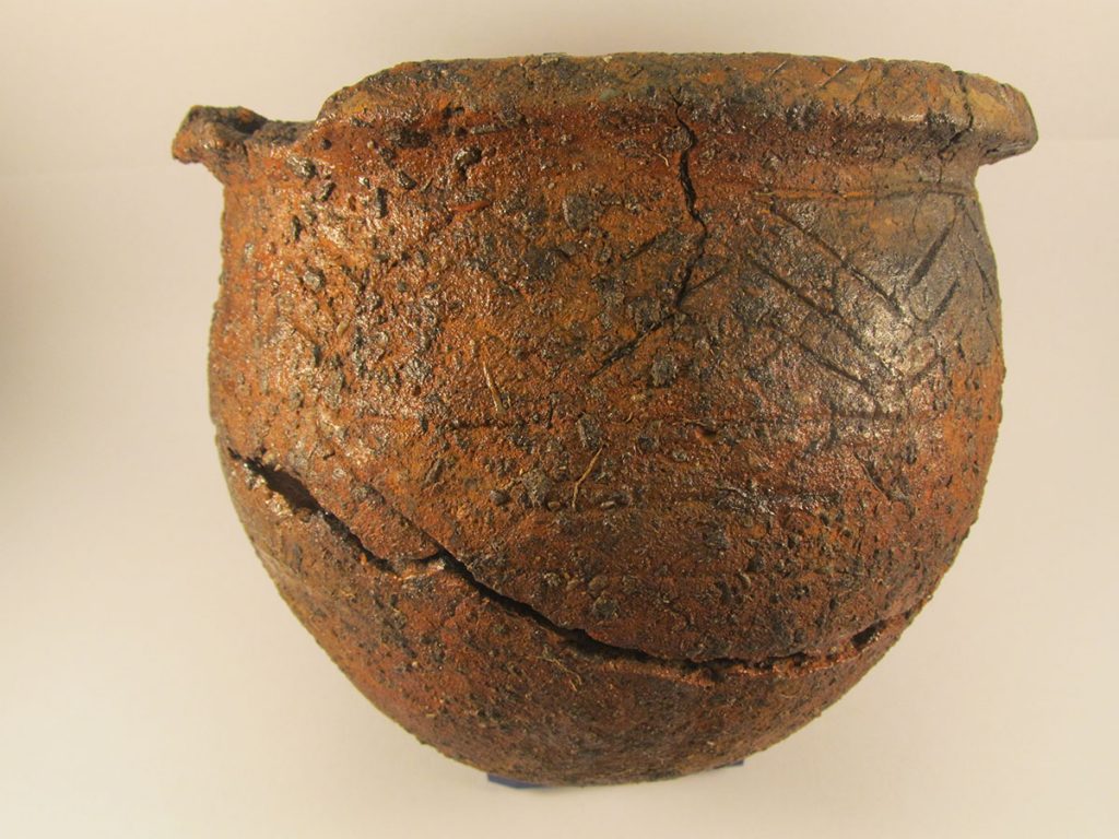
Bipartite vessel following conservation.

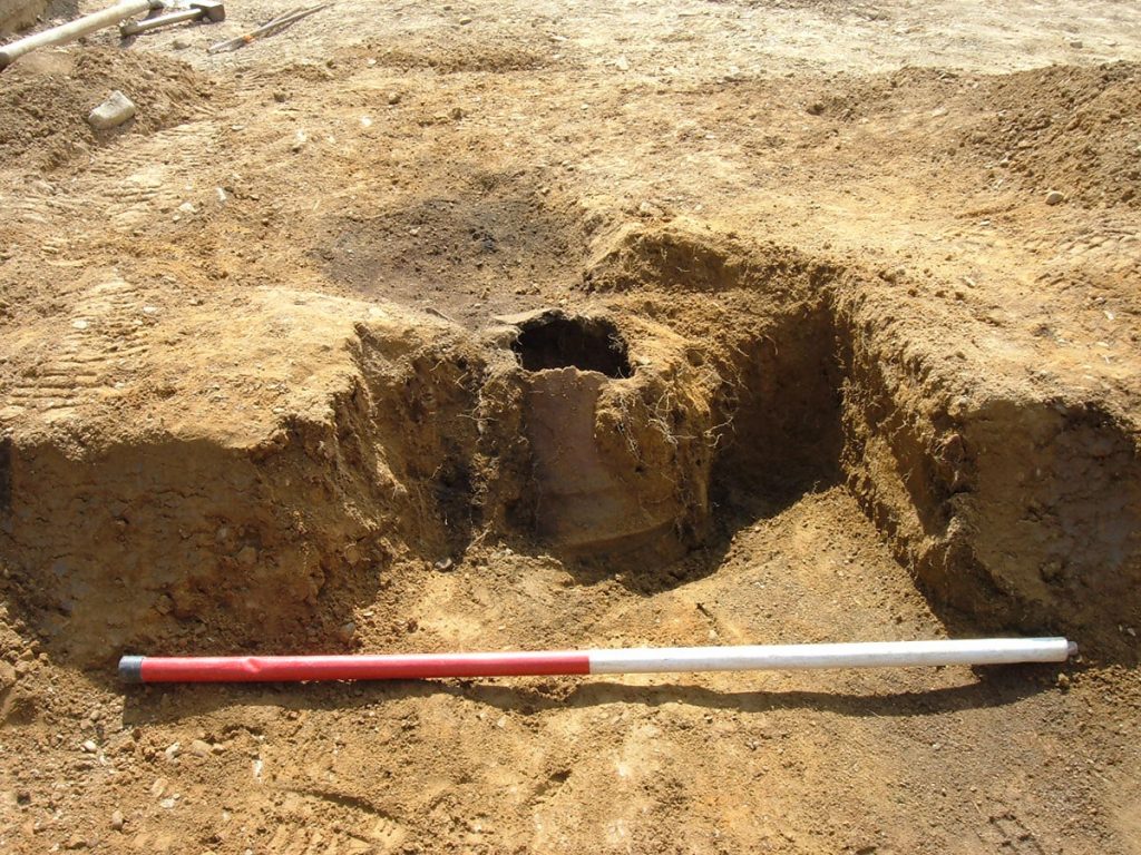
Cordoned urn during excavation.

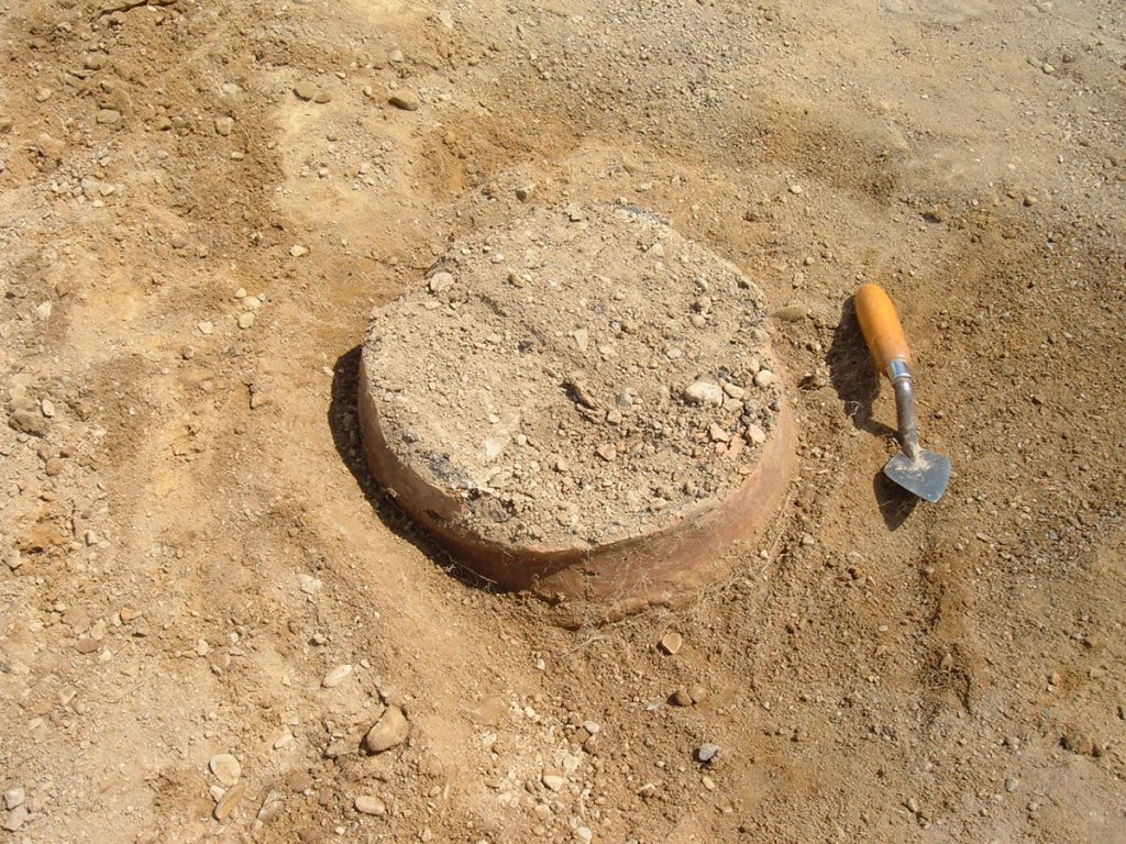
Mid-excavation view of a second cordoned urn.

Useful links

“Excavations”

“Bronze Age Pottery”

“Media coverage”

Sketchfab Model

Bipartite vessel

Cordoned urn

What we did:

Desk-based research
Desk-based research
Planning authorities may request information on the archaeological and historical background to a site before a planning decision is made.

Often, developers may wish to know the archaeological implications of a site prior to purchase or submission of a planning application.

In each instance, a desk-based assessment is typically the first stage in an archaeological assessment. Desk-based assessments will usually compile and analyse data from: local & national archaeological, artefactual, architectural databases; historical mapping, aerial and satelitte imagery; bibliographical and local historical information; published, peer-reviewed archaeological research; unpublished excavation reports; geophysical and geotechnical reports; any other relevant datasets; a comprehensive site inspection to current site conditions and unidentified constraints.

Based on the desk-based study, further options of assessment are available, for example, geophysical survey, testing, monitoring and excavation.

Geophysical survey
Geophysical survey
Geophysical survey is a range of proximal, non-intrusive electromagnetic investigation techniques to map buried archaeological deposits.

This will typically involve a magnetometry survey, but other types of investigation are possible depending on the nature and conditions of the site.
Geophysics often help define the extent of a site and allow targetted investigation (test trenching) of specific features.

In collaboration with established geophysical service providers we can provide high quality, relibale geophysical data and archaeological interpretation.

Test trenching
Test trenching

Planning authorities often seek additional information beyond a desk-based study on the potential for archaeological despoits at a location. In such cases, trenching plans must be submitted to, and licenced by, the National Monuments Service.

Test trenching is a quick and effective means of investigating a sample area of a site (usually 10%). Trench layout is generally informed by the extent of a proposed development, or the results of a geophysical survey. Trenches up to 2 m wide are mechanically excavated in spits to the top of the first archaeological layer encountered (or to subsoil).

Trenching is conducted by experienced, licenced archaeologists who make detailed records on the extent, depth and nature of any archeological features they encounter.

Based on the outcome of test trenching, archaeological excavation may be necessary.

Monitoring
Monitoring

Archaeological monitoring may be required as a stand alone condition or may be recommended following an archaeological assessment,
or as additional mitigation following test trenching or excavation.

It involves observing ground works during the construction stage (topsoil stripping, foundation/ trench excavation).
It may be also necessary during timber felling operations.

Monitoring is carried out by a suitably qualified archaeologist, but does not necessarily require a licence.
Typically an archaeologist will observe groundworks until the risk of exposing archaeological material passes.

Excavation
Excavation

Excavation is usually required where a proposed development encounters archaeological remains that cannot be preserved in-situ.

In such cases, the National Monumnets Service will issue a licence to excavate, and preserve by record, the archaeological features.

Excavation is the systematic removal of archaeological material in a structured and fully-documentet manner.

Site records and reports are ultimately archived with the Archive Unit of the National Monuments Service. Archaeological objects are deposited with the National Museum of Ireland.

The stratigraphic, artefactual and palaeo-environmental evidence is compiled, analysed and interpreted and outlined in a detailed, illustrated final report.

Post-excavation
Post-excavation
We offer a range of post-excavation and analytical services to interpret archaeological sites including:

  • Flotation & processing of bulk environmental samples.
  • Processing of artefacts.
  • Osteo-archaeological reports.
  • Close-up photography

Additional services, for example radiocarbon dating or laboratory-based analysis, can be quickly procured from our extensive network of specialist providers.

Dragoonhill, Co. Wicklow
Kildare Town, Co. Kildare
  • Home
  • Featured Work
  • Services
  • About Us
  • Contact
  • info@archerheritage.ie
Website By, Web Design Dublin